• About UGM
  • About SPs
  • IT Center
  • English
    • Bahasa Indonesia
    • English
Universitas Gadjah Mada Geo-Information for Disaster Management and Spatial Planning
Master of Environmental Science Study Program
Universitas Gadjah Mada
  • Home
  • About Us
    • History
    • Vision Mission
    • Location
  • Academic
    • Lecturer
    • Courses
    • Academic Calendar
  • Contact
  • Gallery
  • Home
  • 2024
Arsip:

2024

Research by UGM Lecturer with Geoinformation Students Reveals Sustainable Agricultural Opportunities in Karst Areas

Research by UGM Lecturer with Geoinformation Students Reveals Sustainable Agricultural Opportunities in Karst Areas

Article Thursday, 28 November 2024

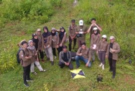
From June to August, a research team from the Graduate School of Universitas Gadjah Mada (UGM) led by Bayu Dwi Apri Nugroho, STP, M.Agr., Ph.D, IPU, ASEAN Eng.. conducted research on the assessment of land potential in the doline valley in the Gunungsewu karst area to support agricultural development of karst and karstic areas. This research was funded by the UGM Graduate School Lecturer Research Grant in 2024.

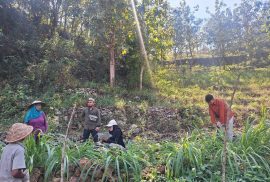
Gunungkidul karst area is considered marginal due to limited water which causes suboptimal agricultural cultivation. This condition has a direct impact on the local economy and threatens local
food security. However, the doline valley in this area has potential to be developed to support sustainable agriculture in karst areas. read more

INTRODUCTION TO SURVEY TOOLS FIELD WORK AND STUDIO MODULE

INTRODUCTION TO SURVEY TOOLS FIELD WORK AND STUDIO MODULE

Article Monday, 18 March 2024

Students of Geo-Information for disaster management for the umpteenth time conducted a field study on Saturday, March 9, 2024. The field study was conducted in Kalisari, Tempuran, Magelang, which is included in the Bompon Watershed. Several materials related to land systems, disasters, and socio-economic conditions were delivered by four lecturers:

1. Dr. Eng. Guruh Samodra, M.Sc.

2. Dr. Arry Retnowati, S.Si., M.Sc.

3. Dr. Indranova Suhendro, S.T., M.Sc.

4. Bondan Galih Dewanto, S.T., M.S.

The field course conducted in this field work and studio module was implemented to accommodate several objectives. The main objective of this course is that students are able to carry out field observations related to research interests in a unit of analysis. In addition, students are also expected to be able to acquire field data using a set of survey tools. There are two survey tools demonstrated, namely Geodetic GPS and Unmanned Small Aircraft System (SPUKTA). read more

Recent Posts

  • Introduction to Aerial Photography Equipment in Kalisari, Magelang
  • Research by UGM Lecturer with Geoinformation Students Reveals Sustainable Agricultural Opportunities in Karst Areas
  • INTRODUCTION TO SURVEY TOOLS FIELD WORK AND STUDIO MODULE
  • Double Degree Candidates UGM-ITC in 2015/2016
  • Profile of Fattiya Ulfa, Double Degree Candidates UGM-ITC
Universitas Gadjah Mada

Secretariat : Graduate School of Universitas Gadjah Mada
3rd floor, Room 304, Teknika Utara Streets,
Pogung, Sleman, Yogyakarta 55281
Telp : 0274 – 564239 (ext. 305)
HP : 0812 2718 2767 (Indri)
E-mail : geo-info.pasca@ugm.ac.id

Ig: geoinfo.ugm

© 2020 Universitas Gadjah Mada

KEBIJAKAN PRIVASI/PRIVACY POLICY

[EN] We use cookies to help our viewer get the best experience on our website. -- [ID] Kami menggunakan cookie untuk membantu pengunjung kami mendapatkan pengalaman terbaik di situs web kami.I Agree / Saya Setuju