• About UGM
  • About SPs
  • IT Center
  • English
    • Bahasa Indonesia
    • English
Universitas Gadjah Mada Geo-Information for Disaster Management and Spatial Planning
Master of Environmental Science Study Program
Universitas Gadjah Mada
  • Home
  • About Us
    • History
    • Vision Mission
    • Location
  • Academic
    • Lecturer
    • Courses
    • Academic Calendar
  • Contact
  • Gallery
  • Home
  • Post by
Post by :

Admin

Introduction to Aerial Photography Equipment in Kalisari, Magelang

Article Wednesday, 7 May 2025

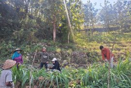
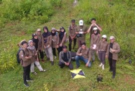
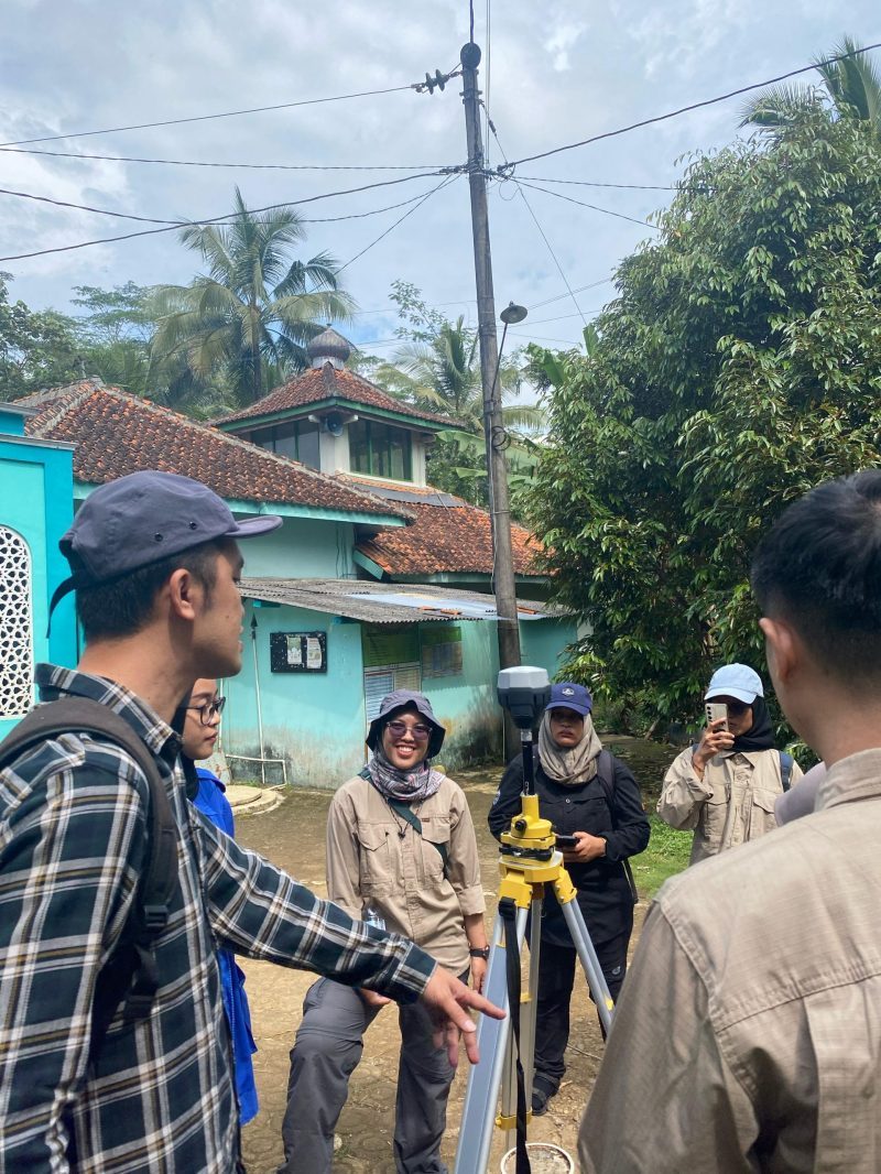
On Saturday, 26 April 2025, Geo-Informatics students specializing in disaster management and spatial planning conducted a fieldwork session in Kalisari, Margoyoso, Salaman, Magelang. The objectives of this fieldwork were to introduce surveying equipment and apply it in practice. The session was supervised by Prof. Dr. rer. nat. Junun Sartohadi, M.Sc., Dr. Eng. Guruh Samodra, S.Si., M.Sc., Dr. Muhammad Anggri Setiawan, S.Si., M.Si., and Dr. rer. nat. Arry Retnowati, S.Si., M.Sc. During the session, students practiced using the Phantom 4 Pro and Mavic 3 Enterprise drones, along with a Geodetic GPS. Aerial photography was conducted by designing flight paths over the study area to capture aerial imagery. Prior to the drone survey, Geodetic GPS measurements were taken to ensure precision correction, resulting in highly accurate aerial photographs.

read more

Research by UGM Lecturer with Geoinformation Students Reveals Sustainable Agricultural Opportunities in Karst Areas

Article Thursday, 28 November 2024

From June to August, a research team from the Graduate School of Universitas Gadjah Mada (UGM) led by Bayu Dwi Apri Nugroho, STP, M.Agr., Ph.D, IPU, ASEAN Eng.. conducted research on the assessment of land potential in the doline valley in the Gunungsewu karst area to support agricultural development of karst and karstic areas. This research was funded by the UGM Graduate School Lecturer Research Grant in 2024.

Gunungkidul karst area is considered marginal due to limited water which causes suboptimal agricultural cultivation. This condition has a direct impact on the local economy and threatens local
food security. However, the doline valley in this area has potential to be developed to support sustainable agriculture in karst areas.

read more

INTRODUCTION TO SURVEY TOOLS FIELD WORK AND STUDIO MODULE

Article Monday, 18 March 2024

Students of Geo-Information for disaster management for the umpteenth time conducted a field study on Saturday, March 9, 2024. The field study was conducted in Kalisari, Tempuran, Magelang, which is included in the Bompon Watershed. Several materials related to land systems, disasters, and socio-economic conditions were delivered by four lecturers:

1. Dr. Eng. Guruh Samodra, M.Sc.

2. Dr. Arry Retnowati, S.Si., M.Sc.

3. Dr. Indranova Suhendro, S.T., M.Sc.

4. Bondan Galih Dewanto, S.T., M.S.

The field course conducted in this field work and studio module was implemented to accommodate several objectives. The main objective of this course is that students are able to carry out field observations related to research interests in a unit of analysis. In addition, students are also expected to be able to acquire field data using a set of survey tools. There are two survey tools demonstrated, namely Geodetic GPS and Unmanned Small Aircraft System (SPUKTA).

read more

Double Degree Candidates UGM-ITC in 2015/2016

Article Wednesday, 28 November 2018

Lufti Gita Iriani, the young generation of Kulon Progo Regency who was born on April 14, 1993. In 2010, began studying at the Gadjah Mada University Vocational School with a concentration in the field of Remote Sensing and Geographic Information Systems. During the study period, the desire arises to continue to a higher level of education, also encouraged by the increasing demand for educational needs in the labor market and opinions of people who underestimate D3 graduates. By following her conscience and ambition, Gita continued her studies at the Muhammadiyah University of Surakarta in 2013 with a concentration in Geography.

read more

Profile of Fattiya Ulfa, Double Degree Candidates UGM-ITC

Article Wednesday, 28 November 2018

Fathiyya Ulfa, the second daughter of three children, all of whom were born in the city of Bukittinggi, West Sumatra. Growing up in a Minang family that is thick with wandering traditions, making Ulfa has aspired to travel around the world. Unlike his age at that time, who called all kinds of professions as a place to dedicate life later. Little Ulfa in his own way has drawn a map of his life’s purpose, becoming someone who really knows what he wants. For him, the purpose of life is to live that goal through action. When we dream of traveling around a giant globe, every small step must incise results that narrow the diameter of the earth that has not been traced.

read more

Vulnerability Assessment of Rice Fields to the Cidurian Watershed Using Landform and Community Perception Approach

Research Wednesday, 28 November 2018

This study examines the vulnerability of paddy fields to Cidurian watershed in Renged Village, Binuang District, Serang Regency, Banten Province. Renged village was chosen as the location of the research area, because there are two factors in the economic condition of the population, the majority of which work as farmers and the geographical location of the research area is located downstream of the Cidurian watershed and 0-2% slope. The results of interviews with local communities flooding in the study area occurred every year in the rainy season, with the largest flood events in the last 20 years occurred in 1994, 2001, and 2013. Based on this, the rice fields in the study area are vulnerable to Cidurian watershed flooding. Vulnerability analysis of rice paddy fields in the study area with landforms and community perception approaches, for vulnerability assessment based on an indicator approach with coring methods and weighting scenarios. Flood hazard analysis based on parameters of depth, duration, and re-flood period.

read more

PSBA Menangkan Research Grant JSPS Dikti

PSBA Achieved Research Grant Japan Society Promotion of Science

Research Friday, 31 August 2012

In order to enhance international cooperation in the field of Disaster Risk Reduction in Indonesia, the UGM Center for Disaster Studies (PSBA) will establish cooperation with the Higher Education Ministry of Education and Culture for the next three years, period 2012/2013 until 2015/2016. This collaboration was established after the UGM PSBA won a Research grant from the Japan Society Promotion of Science (JSPS) by raising the research theme “Developing Model of University – Community Collaborative Information Management for Evacuation Preparedness in Tourism Destinations: Case Study Kyoto-Japan and Yogyakarta-Indonesia”.

read more

Recent Posts

  • Introduction to Aerial Photography Equipment in Kalisari, Magelang
  • Research by UGM Lecturer with Geoinformation Students Reveals Sustainable Agricultural Opportunities in Karst Areas
  • INTRODUCTION TO SURVEY TOOLS FIELD WORK AND STUDIO MODULE
  • Double Degree Candidates UGM-ITC in 2015/2016
  • Profile of Fattiya Ulfa, Double Degree Candidates UGM-ITC
Universitas Gadjah Mada

Secretariat : Graduate School of Universitas Gadjah Mada
3rd floor, Room 304, Teknika Utara Streets,
Pogung, Sleman, Yogyakarta 55281
Telp : 0274 – 564239 (ext. 305)
HP : 0812 2718 2767 (Indri)
E-mail : geo-info.pasca@ugm.ac.id

Ig: geoinfo.ugm

© 2020 Universitas Gadjah Mada

KEBIJAKAN PRIVASI/PRIVACY POLICY